
Sources for Frederickson Neighbors
No public source is a live household roster for Frederickson. PublicGIS establishes which lots touch, sit across a road, or merely fall nearby. The Assessor-Treasurer record adds a dated owner display, mailing address, situs address, and parcel context. Recorded plats, covenants, and easements can explain a shared lane or subdivision relationship. Election records have narrow lawful uses. The Frederickson Advisory Commission and Frederickson Clover Creek Community Council add public civic context, but neither publishes an official member directory.
| Local source | What it shows about a block | Access channel |
|---|---|---|
| PublicGIS 3.0 | Parcel geometry, roads, layers, selected attributes | Free county viewer |
| ATIP | Dated owner, situs, mailing, parcel, and sales context | Web portal or Assessor help |
| Auditor records | Plats, covenants, easements, and indexed parties | Online index; older books and office or mail requests |
| VoteWA and Elections | Registration and precinct facts within use limits | Official lookup or data request |
| FAC and FCCCC | Planning cases, public meetings, civic history, contacts | Public pages and meeting records |
Use the map first because a list of street numbers cannot show geometry. Then record each parcel independently. A parcel owner is not automatically an occupant, and a person named in a covenant is not automatically one of today's Frederickson neighbors.
Define Nearby Frederickson Neighbors
Decide what “neighbor” means before collecting names. A touching parcel shares a boundary with the target. An across-road parcel may be close but separated by public right-of-way. A nearby parcel sits within a stated map extent or distance without touching. Keep those categories in separate columns. Otherwise, a cul-de-sac, drainage tract, private lane, or wide arterial can turn a simple block list into a false claim of adjacency.
- Parcel
- A mapped unit of land identified by a county account number.
- Situs address
- The physical address assigned to the land, distinct from the tax mailing address.
- Right-of-way
- Land reserved for a road or public use that can separate parcels.
- Buffer
- A stated distance around a point or shape used to define nearby.
Write the definition and map scale at the top of the research notes. That allows a later reader to understand why one parcel was included while another was excluded. It also prevents “the block” from quietly expanding until it covers a whole Frederickson street.
Select Frederickson Parcels in PublicGIS
Pierce County PublicGIS 3.0 accepts a site address, an intersection written with an ampersand between road names, a parcel number, or a place of interest. Zoom to the target, select the parcel layer, and use Identify to open available attributes. Roads, aerial imagery, parcel boundaries, and building footprints can help distinguish direct contact from across-street proximity. Save the map date, legend, scale, and layer choices with the result.
The viewer offers measurement, coordinates, print, traverse, and drawing tools, but the research did not verify a dedicated one-click adjacent-parcel or buffer command. Do not promise one. Select nearby parcels one by one or define a transparent distance with the available controls. Recent updates changed measurement placement, selected-feature outlines, and drawing behavior. Current road-centerline, parcel, zoning, and annexation changes also mean today's view cannot reconstruct an old block by itself.
Map Frederickson Neighbors by Parcel
The block workflow moves from one verified address to a set of separately checked parcels. It is not a whole-street sweep. The full named-road chain belongs in the Frederickson street directory. Keep a screenshot or print view only when its date, layers, and extent are visible enough to repeat the work.
- Search the target situs address in PublicGIS and verify that the point lands on the expected parcel.
- Record its parcel or account number, legal context, road edge, and map date.
- Select each touching parcel. Put across-road and nearby parcels in their own categories.
- Open each matching ATIP record and keep owner, situs, and mailing fields distinct.
- Note a plat, covenant, easement, or planning case that explains the block relationship.
The useful output is a research table, not a list of presumed occupants. Give each row a parcel number, relation category, situs, owner display, source date, map layer, and uncertainty note. If the assessor name and mailing address differ, report both labels as shown rather than treating the difference as an error. County guidance calls the parcel number the best lookup key.
Roads Divide Frederickson Blocks
Frederickson's official map vocabulary includes Brookdale Road East, Canyon Road East, Military Road East, Woodland Avenue East, Waller Road East, Greenleaf Drive East, and many numbered roads and avenues. Records may drop “East,” shorten a road type, or use a crossroad description. Preserve the source spelling beside a normalized modern form so two similar addresses do not collapse into one.
County addressing is especially important because Frederickson is unincorporated. Ordinance 84-152 anchors the addressing grid used for historical investigation. Plats, road-centerline updates, and jurisdiction changes can alter how a location is described. Legal parcel geometry and recorded plats are stronger evidence than a familiar neighborhood name. A road or right-of-way can also separate two lots that look adjacent at a broad zoom.
Frederickson Planning Records Nearby
The Frederickson Advisory Commission advises on land-use matters in the community-plan area. Public agendas and planning cases may identify a development, parcel reference, applicant, or public participant. Those records can explain new roads, a subdivision, or why the physical block changed. They are planning evidence, not a roll of private residents.
Frederickson's plan began in 2003 and was updated through 2020 and 2021, with county planning notices continuing in later cycles. Date any planning map used in neighbor research. The census-designated place, community-plan area, county addressing geography, and postal ZIP areas answer different boundary questions. A planning participant also may live elsewhere, so the role must remain attached to the planning record.
FCCCC Adds Frederickson Civic Context
The Frederickson Clover Creek Community Council is a nonprofit civic voice, not a government office. Its public history traces organizational documents to 1978 and bylaws to 2023. Council materials can supply civic contacts, meeting history, and language local residents use for community issues. Research found no public member directory, so do not infer who belongs or lives within a certain block.
Review the FCCCC public history beside the captured page below.
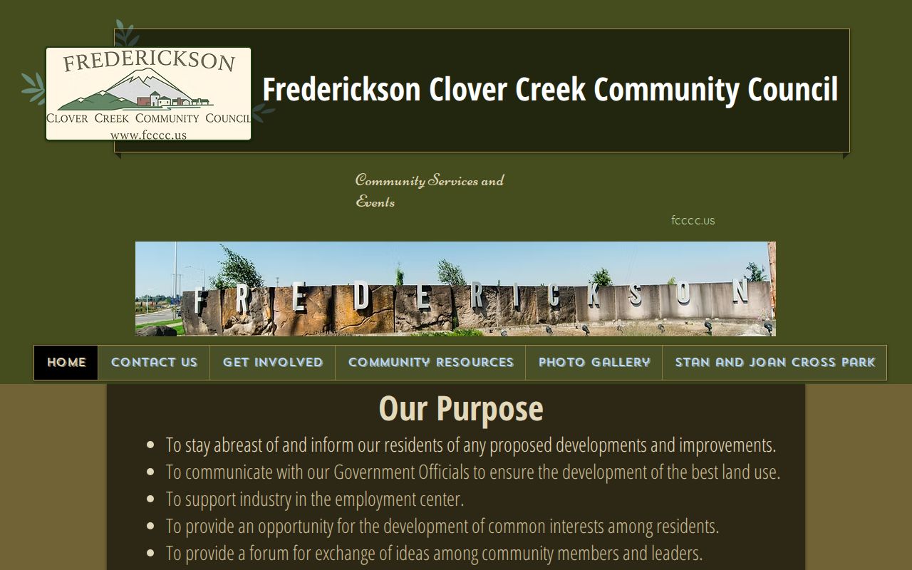
The image documents the civic source itself. Parcel and county records remain the evidence for a specific address relationship. Public officers or named contacts appear because of their organizational roles, not because the page verifies their private address.
Frederickson Voter Data by Block
Washington makes current precinct and voter lists public subject to RCW 29A.08.710, .720, and .740, plus confidentiality rules. The file does not record party preference. It also cannot reveal how anyone voted. A county data request can ask for district or precinct data, current-election matchbacks, or date-specific voting history, but the requester must choose a scope and certify the permitted use.
Pierce County Elections accepts its form by email, mail, or in person. Save the extraction date, county, precinct, and election year. “Active” describes a file status; it does not prove physical presence when searched. Voter data cannot be used for advertisements, offers, or solicitations for money, services, or value. ACP-protected records may use substitute or suppressed address information.
Frederickson Covenants and Easements
Recorded documents can explain shared features around a block. A plat defines lots and roads. A covenant may establish common limits. An easement can document shared access, drainage, or utilities. Pierce County's online Auditor index generally reaches back to 1984, while pre-1984 work uses Index Books and office or mail image requests. The search interface works by names, dates, and instrument numbers, not by street address or parcel number.
Start with ATIP or PublicGIS, collect owner and legal-description context, and then search the recorder. Keep every named party's role. A developer, trustee, prior owner, or utility named in an easement is not one of the current Frederickson neighbors. Watermarked online images are not certified, and only proper title review determines vested ownership.
Official Frederickson Neighbor Records
Official systems and commercial neighbor tools serve different roles. County sources identify the public record, custodian, date, and field meaning. Commercial tools compile data from many places and may preserve an old address, merge names, or hide the source behind a fee. They are not authority for a claim about Frederickson neighbors.
| Source type | Best use | Main limit |
|---|---|---|
| PublicGIS and ATIP | Map and dated parcel-owner context | Does not prove current occupancy |
| Auditor and planning files | Recorded land ties and public project context | Named parties may have nonresident roles |
| Commercial compiled category | Possible lead requiring official verification | Source, date, accuracy, and cost can be unclear |
Privacy for Frederickson Neighbors
Parcel rolls do not name every person in a home. Public utility and delivery data are not part of this workflow. Washington's Address Confidentiality Program can supply a substitute address and mail forwarding for qualified survivors and other protected participants. Actual secure locations are not public. A conflicting address is a reason to stop, minimize detail, and follow the custodian's confidentiality rules.
Keep only facts needed for lawful neighborhood curiosity, civic research, or reconnection. Do not publish a protected exact address, unique voter identifier, full birth date, sealed court detail, or sensitive recorder information. A public field can still be harmful when copied into a permanent block roster. Contact the original custodian when a parcel, case, or index entry is wrong.
Lawful use. Research Frederickson neighbors without watching, tracking, harassing, intimidating, or exposing anyone. Public access never removes those limits.